COGEAR GNSS Monitoring
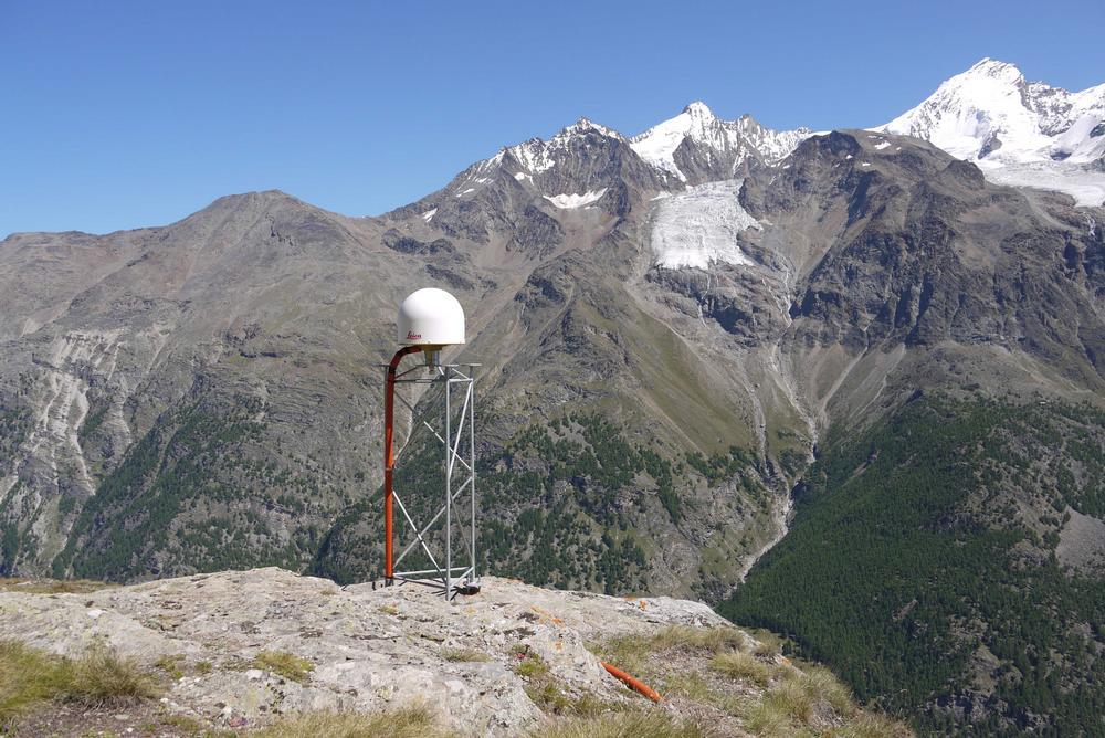
COGEAR GNSS station RAND
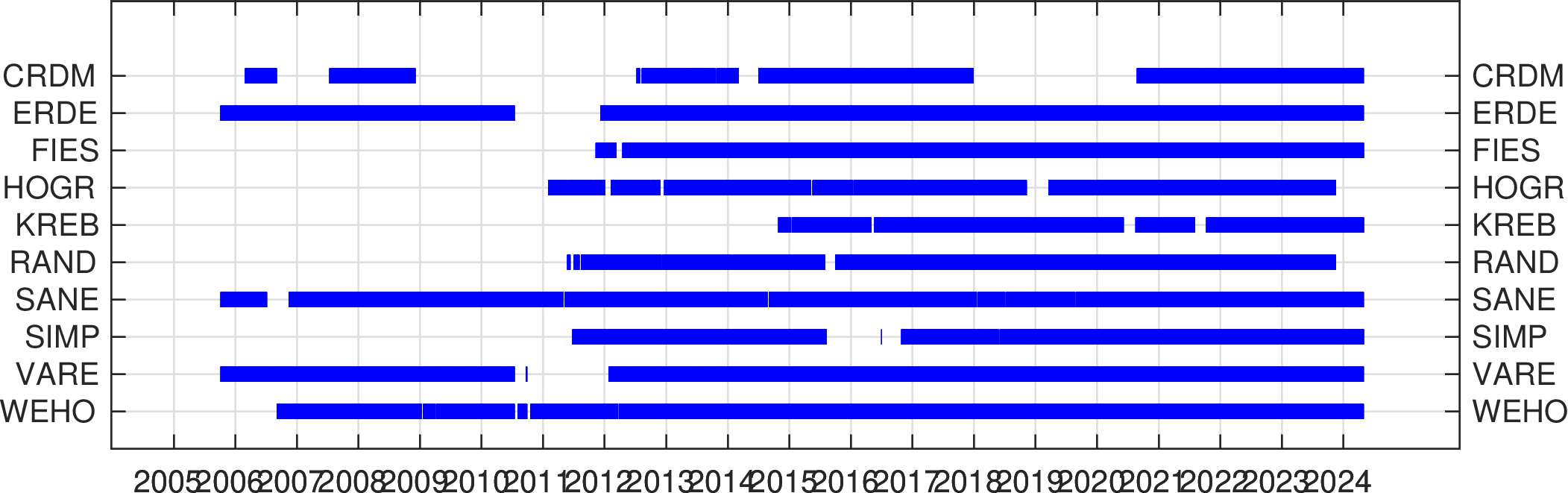
The COGEAR GNSS network consists of 10 permanent GNSS stations installed by the MPG and operated continuously in the frame of the project COGEAR (Coupled Seismogenic Geohazards in Alpine Regions). COGEAR is a project of the Competence Center Environment and Sustainability (CCES) of the ETH Domain.
The goals of the COGEAR GNSS network are:
- observations of long-term tectonic deformations
- observations of co-seismic deformations
- investigation of atmospheric parameters
- reference network for monitoring of local deformations and mass movements
In cooperation with external pageswisstopo, the COGEAR network is referenced to the national external pageAGNES network. The data of the COGEAR GNSS network is operationally processed at MPG on a daily basis with Bernese GPS software, together with a subset of 11 AGNES stations. The GOGEAR data is shared with swisstopo, where the data is integrated in the official processing of the AGNES network.
COGEAR and AGNES GNSS networks in the Valais area
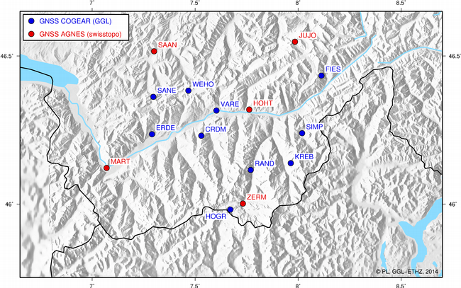
COGEAR and AGNES stations in the Valais area (clickable)
COGEAR GNSS stations operated by the MPG
COGEAR station data availability